
Duoro kɔre:Volta districts.png
A daŋkaabo semmo: 776 × 600 pixels. Amineresolutions: 311 × 240 pixels | 621 × 480 pixels | 994 × 768 pixels | 1,056 × 816 pixels.
A dage fara meŋa (1,056 × 816 pixels, file size: 43 KB, MIME type: image/png)
Leɛroo
| Wuloo |
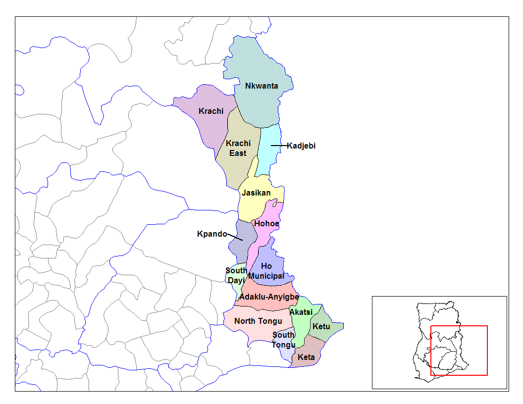
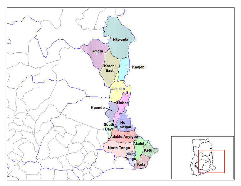
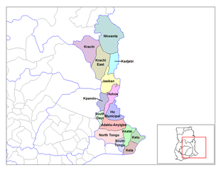
English: Map of the districts of the Volta region of Ghana. Created by Rarelibra for public domain use. Created using MapInfo Professional v7.5 and various mapping resources. |
| Bebiri | 28 Gyoone 2006 (original upload date) |
| Yizie | Fo toma |
| Gansɛgera | User:Rarelibra |
Sore teroo
| I, the copyright holder of this work, release this work into the public domain. This applies worldwide. In some countries this may not be legally possible; if so: I grant anyone the right to use this work for any purpose, without any conditions, unless such conditions are required by law. |
Original upload log
- (del) (cur) 08:03, 5 March 2006 . . Rarelibra (Talk | contribs) . . 1056x816 (44,138 bytes) (Map of the districts of the Volta region of Ghana. Created by Rarelibra for public domain use. Created using MapInfo Professional v7.5 and various mapping resources.)
Daga yɛlkori
Tɔ a bebiri/wagere a kaa a daga wagere na o naŋ sãã.
| Bebiri/Wɔgre | Bondemanna | Manna wulo | Tontona | Teɛroo | |
|---|---|---|---|---|---|
| pampana | 14:01, 28 Gyoone 2006 | | 1,056 × 816 (43 KB) | Ahanta | from en:districts of ghana Map of the districts of the Volta region of Ghana. Created by Rarelibra for public domain use. Created using MapInfo Professional v7.5 and various mapping resources. [edit] I, the creator of this work, hereby release it into th |
Daga tontone
The following 2 pages use this file:
Donɛɛ zaa daga tontone
Ana wikis mine ŋa maŋ tonna neŋ a daga ŋa:
- Era enna ca.wikipedia.org
- Era enna ceb.wikipedia.org
- Era enna dag.wikipedia.org
- Era enna da.wikipedia.org
- Era enna de.wikipedia.org
- Era enna ee.wikipedia.org
- Era enna en.wikipedia.org
- Era enna es.wikipedia.org
- Era enna fa.wikipedia.org
- Era enna fr.wikipedia.org
- District (Ghana)
- Région de la Volta
- Adaklu-Anyigbe
- Akatsi
- Dayi sud
- Tongu nord
- Tongu sud
- Nkwanta sud
- Kpando
- Kadjebi
- Jasikan
- District municipal de Keta
- Ketu sud
- Ketu nord
- Nkwanta nord
- Biakoye
- District municipal d'Ho
- District municipal d'Hohoe
- Krachi est
- Krachi ouest
- Modèle:Infobox District du Ghana
- Modèle:Infobox District du Ghana/Documentation
- Era enna gpe.wikipedia.org
- Era enna ha.wikipedia.org
Kaabu teŋdaa bonne kyaare a gaŋe ŋa.