
Duoro kɔre:Ghana rel 2007.jpg
A daŋkaabo semmo: 496 × 599 pixels. Amineresolutions: 199 × 240 pixels | 397 × 480 pixels | 636 × 768 pixels | 1,047 × 1,265 pixels.
A dage fara meŋa (1,047 × 1,265 pixels, file size: 807 KB, MIME type: image/jpeg)
Leɛroo
| Wuloo |
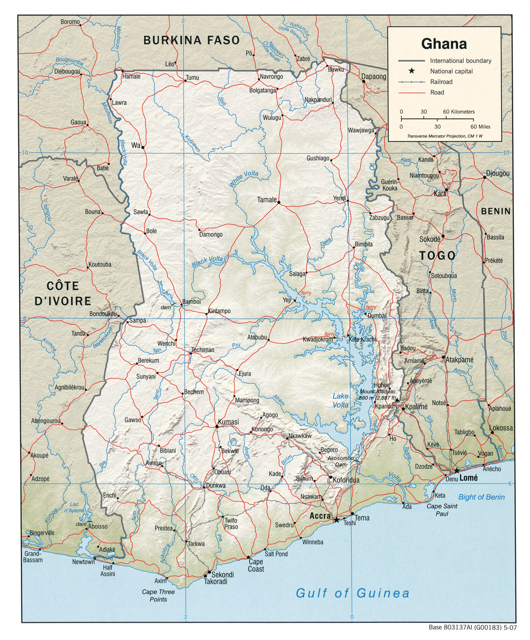
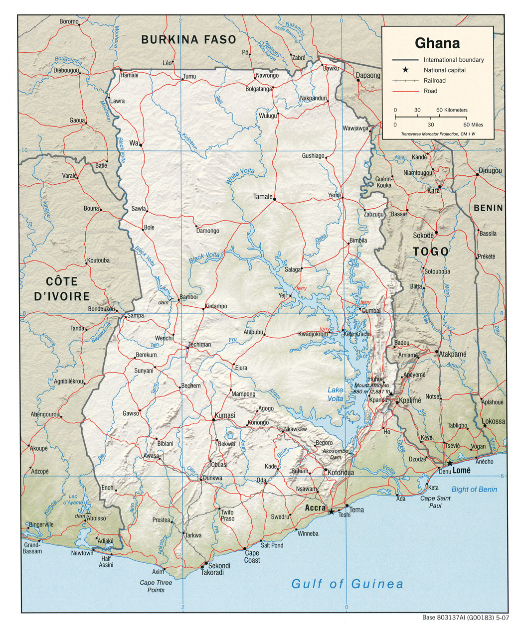
English: CIA shaded relief map of Ghana, 2007. |
| Bebiri | |
| Yizie | University of Texas Libraries, Perry-Castañeda Library Map Collection: Ghana Maps |
| Gansɛgera | United States Central Intelligence Agency |
Sore teroo
This image is in the public domain because it contains materials that originally came from the United States Central Intelligence Agency's World Factbook.
|
 |
Daga yɛlkori
Tɔ a bebiri/wagere a kaa a daga wagere na o naŋ sãã.
| Bebiri/Wɔgre | Bondemanna | Manna wulo | Tontona | Teɛroo | |
|---|---|---|---|---|---|
| pampana | 16:10, 28 Gyɛnoɔre 2011 | | 1,047 × 1,265 (807 KB) | Fentener van Vlissingen | {{Information |Description ={{en|1=CIA shaded relief map of Ghana, 2007.}} |Source =University of Texas Libraries, Perry-Castañeda Library Map Collection: [http://www.lib.utexas.edu/maps/ghana.html Ghana Maps] {{PCL|Ghana_rel_2007.jpg|africa/} |
Daga tontone
The following page uses this file:
Donɛɛ zaa daga tontone
Ana wikis mine ŋa maŋ tonna neŋ a daga ŋa:
- Era enna de.wikipedia.org
- Era enna en.wikipedia.org
- Era enna no.wikipedia.org
- Era enna ru.wikipedia.org
- Era enna sco.wikipedia.org