
Duoro kɔre:Districts of the Upper East Region (2012).svg

Size of this PNG preview of this SVG file: 744 × 524 pixels. Amineresolutions: 320 × 225 pixels | 640 × 451 pixels | 1,024 × 721 pixels | 1,280 × 902 pixels | 2,560 × 1,803 pixels.
A dage fara meŋa (SVG file, nominally 744 × 524 pixels, file size: 1.37 MB)
.svg)
Leɛroo
| Wuloo |
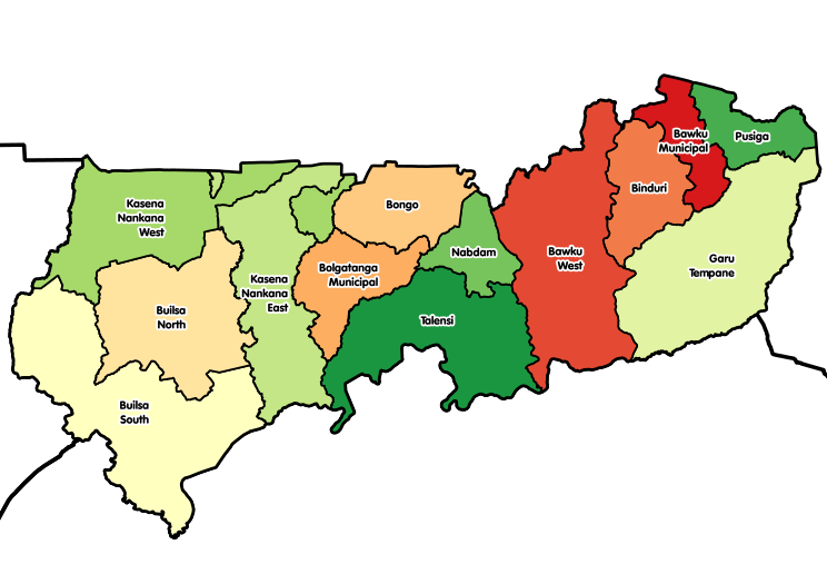
English: Map showing all 13 districts of the Upper East Region of Ghana, including the new districts that were created in 2012. |
| Bebiri | |
| Yizie | Fo toma |
| Gansɛgera | Macabe5387 |
| SVG genesis |
Sore teroo
I, the copyright holder of this work, hereby publish it under the following license:
This file is licensed under the Creative Commons Attribution-Share Alike 4.0 International license.
- Fo ba erɛ boŋ zaa:
- a pɔŋ – ka fo naŋ tɔgele, ŋmɛyaare ane toɔle a toma
- a laŋtaa – a sage a toma
- A yi a sobie ama yuoŋ:
- de manneneŋ – Aseŋ ka fo tere emmuo naŋ senne,a wanne sase-miri naŋ wullo o sobuo ane ka tɛgere kaŋ eɛ. Fo na baŋ eɛ lɛ yi lɛ na zaa fõõ naŋ boɔrɔ, kyɛ ka a ta e ŋa o soba la ko fo sori bee fo de tonne.
- tɔreko ayitaaloŋ mine – Ka fooŋ wa leɛ laŋtaa, leɛre kyɛ bee mɛ poɔ a yɛlɛ mineŋ see ka fo poŋ a fo boma na fo naŋ leɛre. a lɛ ne o zu bee sagedeebo laasene ka o e a papa meŋa.
Daga yɛlkori
Tɔ a bebiri/wagere a kaa a daga wagere na o naŋ sãã.
| Bebiri/Wɔgre | Bondemanna | Manna wulo | Tontona | Teɛroo | |
|---|---|---|---|---|---|
| pampana | 12:40, 29 Disembare 2017 | | 744 × 524 (1.37 MB) | Macabe5387 | User created page with UploadWizard |
Daga tontone
The following 4 pages use this file:
Donɛɛ zaa daga tontone
Ana wikis mine ŋa maŋ tonna neŋ a daga ŋa:
- Era enna ceb.wikipedia.org
- Era enna de.wikipedia.org
- Era enna en.wikipedia.org
- Bolgatanga
- Districts of Ghana
- Navrongo
- Tongo, Ghana
- Paga
- Upper East Region
- Bawku
- Zebilla
- Bongo District
- Bolgatanga Municipal District
- Builsa North Municipal District
- Kassena-Nankana Municipal District
- Template:Districts of the Upper East Region of Ghana
- Bawku Municipal District
- Bawku West District
- Garu District
- Talensi-Nabdam District
- Administrative divisions of Ghana
- Kassena-Nankana West District
- Sandema
- Bongo, Ghana
- Garu, Ghana
- Binduri (district)
- Builsa South (district)
- Nabdam (district)
- Pusiga (district)
- Talensi (district)
- User:GerardM/Districts of Ghana
- Garu-Tempane District
- Builsa District
- Bolgatanga East District
- Tempane District
- Kassena-Nankana District
- Era enna es.wikipedia.org
- Era enna gpe.wikipedia.org
Kaabu teŋdaa bonne kyaare a gaŋe ŋa.
.svg)
.svg)